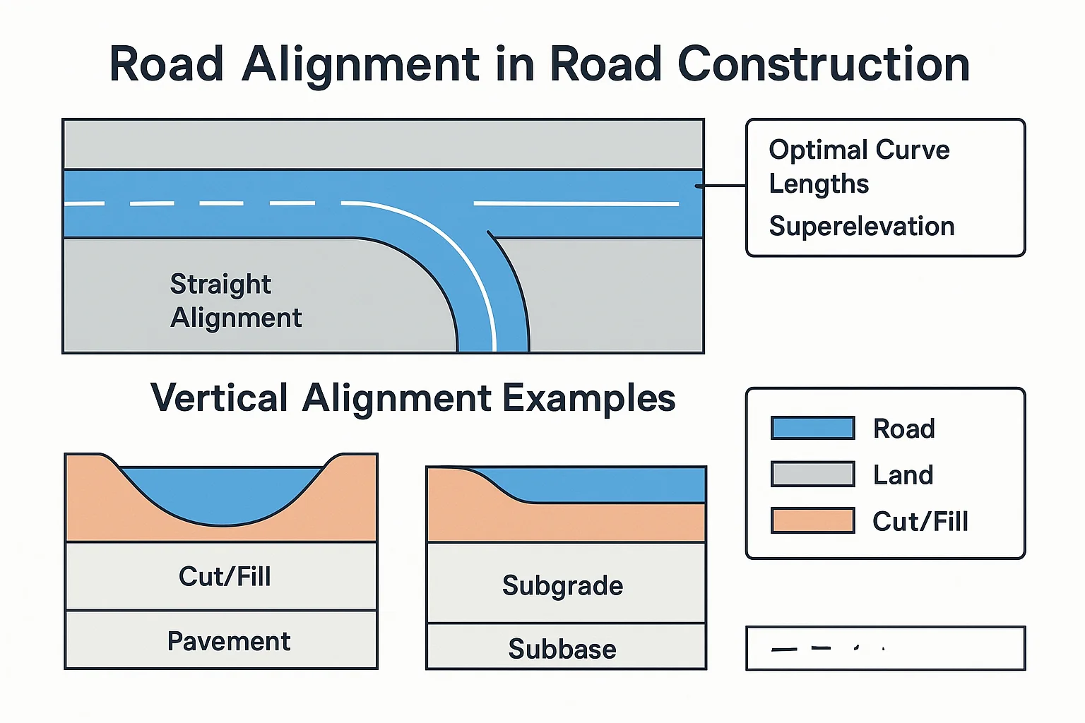
Road alignment is one of the most important decisions in road construction because it controls how safely, smoothly, and economically a road will function over its full life. In simple terms, road alignment is the position and direction of the road on the ground. It shows where the road will pass horizontally and vertically through the terrain.
For civil engineers, understanding road alignment is not just about drawing a centerline. It involves survey work, geometric design, terrain study, drainage planning, earthwork optimization, and compliance with highway engineering standards. A well-planned alignment reduces construction cost, improves riding quality, and supports long-term pavement performance.
In this article, you will learn the meaning of road alignment civil engineering, the main types, field procedure, engineering considerations, and practical checks used during construction.
What Is Road Alignment?
Road alignment is the arrangement of the road trace along the ground. It includes two parts: horizontal alignment, which is the road layout in plan view, and vertical alignment, which is the road profile along the elevation.
The goal is to connect two points in a way that is safe, economical, and suitable for traffic. A good alignment minimizes sharp curves, steep gradients, excessive cut and fill, and unnecessary disturbance to the terrain. It also helps the pavement drain properly and perform better over time.
Main Types of Road Alignment
1. Horizontal Alignment
Horizontal alignment refers to the path of the road as seen from above. It includes straight sections, circular curves, and transition curves. This part of design affects vehicle steering, lateral stability, sight distance, and comfort.
2. Vertical Alignment
Vertical alignment is the road profile along the length of the route. It includes gradients, summit curves, and valley curves. Proper vertical alignment helps manage drainage, visibility, and vehicle operation on slopes.
3. Combined Alignment
In actual highway engineering, both horizontal and vertical alignment must work together. A road may look acceptable on plan, but if the grade and curvature are poorly matched, it can still become unsafe or difficult to construct.
Why Road Alignment Matters in Civil Engineering
Road alignment affects almost every major project outcome. It influences land acquisition, excavation quantity, embankment height, drainage design, safety, travel time, and maintenance needs.
- Safety: Proper curves and gradients reduce accident risk.
- Economy: Good alignment reduces earthwork and structure costs.
- Comfort: Smooth alignment improves riding quality.
- Drainage: Correct levels prevent waterlogging and pavement damage.
- Durability: Better drainage and geometry support longer pavement life.
This is why road alignment civil engineering is a core part of highway planning, not just a drafting exercise.
Factors Affecting Road Alignment
Several site and design conditions influence the final route selection. The alignment must suit both engineering requirements and local constraints.
| Factor | How It Affects Alignment |
|---|---|
| Terrain | Plain, rolling, and hilly areas require different route choices and grades. |
| Traffic | Higher traffic volume usually requires better curvature, visibility, and safety control. |
| Drainage | The road should avoid waterlogged areas and allow runoff to move away from the pavement. |
| Soil and ground conditions | Weak soil, rock, or erosion-prone ground can affect earthwork and stability. |
| Land use and utilities | Buildings, farmland, pipelines, and other utilities may force route adjustments. |
| Project standards | Design must follow the relevant highway engineering standards and project-specific criteria. |
Road Alignment Field Procedure
The road alignment field procedure generally starts with survey, continues with centerline marking, and ends with setting out for construction. The exact sequence may vary by project, but the basic approach is similar for most roads.
- Reconnaissance survey: Engineers study the area, note terrain, drainage, settlements, and possible obstacles.
- Preliminary survey: A few possible routes are measured and compared for length, earthwork, and cost.
- Final location survey: The selected route is precisely surveyed using total station, GPS, theodolite, leveling equipment, or other approved methods.
- Centerline marking: Pegs or markers are fixed along the proposed road centerline.
- Profile and cross-section survey: Ground levels are recorded to prepare the vertical design and estimate earthwork.
- Setting out curves and grades: Horizontal curves, vertical curves, chainages, and reference points are established at site.
- Construction control: During earthwork and pavement work, the alignment is checked against the drawings and benchmarks.
This road alignment field procedure is important because even a good design can fail if the site layout is marked incorrectly.
Engineering Specifications and Design Considerations
There is no single universal set of road alignment values for all projects. The correct geometry depends on the road class, traffic speed, terrain, and the applicable code. In practice, engineers refer to relevant highway engineering standards and project documents for details such as design speed, curve radius, gradient limits, and sight distance criteria.
Some standard design considerations include:
- Design speed: Higher speed roads generally need gentler curves and better visibility.
- Sight distance: The driver must be able to see enough of the road ahead for safe stopping and overtaking where applicable.
- Gradient: Steep grades increase fuel use, reduce speed, and can affect heavy vehicles.
- Curve transitions: Transition curves improve comfort and reduce sudden lateral movement.
- Superelevation: On horizontal curves, the roadway may be tilted to help vehicles negotiate turns safely.
For road alignment and pavement layers, the geometry must also support proper drainage and structural performance. Although IRC pavement design focuses mainly on pavement thickness and layer design, it is influenced by the chosen alignment because drainage, subgrade conditions, and traffic operation all interact with the road geometry.
Standards and Code Compliance
Road layout and geometric design should follow the applicable highway engineering standards, such as IRC guidelines and the relevant project specifications. In Indian highway projects, IRC and MoRTH documents are commonly used for alignment, geometric design, earthwork, drainage, and pavement construction requirements.
However, engineers should not assume that one code value applies everywhere. The final specification may vary depending on the road category, terrain classification, traffic loading, authority requirements, and design speed. Always verify the current project drawings, approval notes, and latest governing standards before construction.
Road Alignment vs Road Location: Are They the Same?
These terms are related, but they are not exactly the same. Road location refers to the general route selected on the map or through the terrain. Road alignment is the exact geometric position of that road, including its curve layout, gradients, and centerline setting.
In short, location tells where the road goes, while alignment tells how the road is shaped and laid out on the ground.
Practical Example of Road Alignment on a Project
Suppose a rural two-lane road must connect a village to a market town. The engineer first studies the terrain and drainage lines. A route through low-lying ground may appear shorter, but it could require heavier embankment and larger drainage structures.
Instead, a slightly longer alignment on firmer ground may reduce flood risk, lower maintenance needs, and provide smoother vertical grades. This is a typical example of how road alignment is chosen not just for distance, but for total performance and construction feasibility.
Quality Control Checks During Construction
Good alignment control is essential once construction begins. Even minor setting-out errors can create drainage problems, pavement irregularities, or unsafe driving conditions.
- Confirm benchmarks and reference points before earthwork starts.
- Check centerline pegs and chainage regularly.
- Verify curve layout, offsets, and radius as per drawing.
- Inspect formation levels before placing subgrade and pavement layers.
- Ensure side drains and cross-fall support water movement away from the carriageway.
- Recheck alignment after major excavation, filling, or structure work.
A common mistake is to focus only on width and layer thickness while ignoring the exact line and level of the road. In road construction, geometry is as important as material quality.
Common Problems Caused by Poor Road Alignment
- Excessive cutting and filling, increasing cost and time.
- Poor drainage and standing water on the pavement.
- Sharp curves and blind spots that reduce safety.
- Steep gradients that are difficult for heavy vehicles.
- Uneven settlement due to unsuitable ground conditions.
- Premature pavement distress caused by abnormal loading or water damage.
FAQ
What is road alignment in simple words?
It is the exact path and shape of a road on the ground, including its direction, curves, and slopes.
Why is road alignment important in highway projects?
It controls safety, drainage, construction cost, and the long-term performance of the pavement.
What is the road alignment field procedure?
It usually includes reconnaissance, survey, centerline marking, leveling, curve setting, and construction control at site.
Does road alignment affect pavement design?
Yes. Alignment affects drainage, subgrade conditions, traffic behavior, and therefore the assumptions used in pavement design.
Which standards are used for road alignment design?
Relevant IRC and MoRTH requirements are commonly used in India, along with project-specific drawings and authority standards.
What is the most common mistake in road alignment work?
One common mistake is poor field setting out, which can lead to wrong curves, incorrect levels, and drainage issues later.
Conclusion
Road alignment is the backbone of road construction. A well-designed route improves safety, reduces cost, supports drainage, and helps the pavement perform as intended. For civil engineers and site teams, careful survey, accurate setting out, and compliance with the relevant standards are essential.
Whether you are studying highway engineering or managing site execution, understanding road alignment will help you make better technical decisions from planning to pavement construction.